
End of Week Weather Update
- WCBI

- Apr 3, 2025
- 1 min read
Active conditions maintain through the end of the week and into the weekend. While the pattern remains unsettled, specific details hold uncertain.

THURSDAY NIGHT: Potential for storms will continue across northern and northwestern Mississippi throughout the night. The rest of the area will continue to be warm and muggy, with lows only falling into the lower 70s.
FRIDAY: Looks like a little bit of a break. A few showers may be possible for some, but most of the energy for severe storm potential stays off to our NW. Toasty temperatures hold in the middle to upper 80s! warm overnight lows continue in the lower 70s.

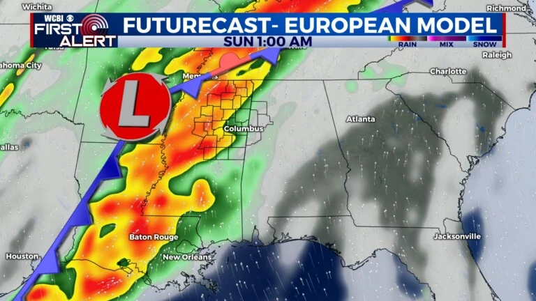
WEEKEND: The pattern holds! Saturday and into Sunday will bring another round of active weather, this time for the whole area. Specific timing is still uncertain. Scattered storms will be possible ahead of the main line during the afternoon, with increased potential for severe threats in the evening/overnight. All severe threats will be possible, including tornadoes. The system will clear East by Sunday morning, as cooler and drier air moves in from behind. This will allow for some calmer conditions next week.
This article was taken from WCBI in Columbus, MS.
The article was written by Ashleigh Bryant.
You can find the original article here:
The Refuge 107.1 is a WCBI affiliate.


Comments